|
 |
|
| |
Essential for your travel needs.
Let's be more moved - turn a trip of sights in Japan into a trip of feeling!
|
|
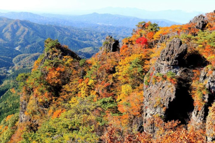
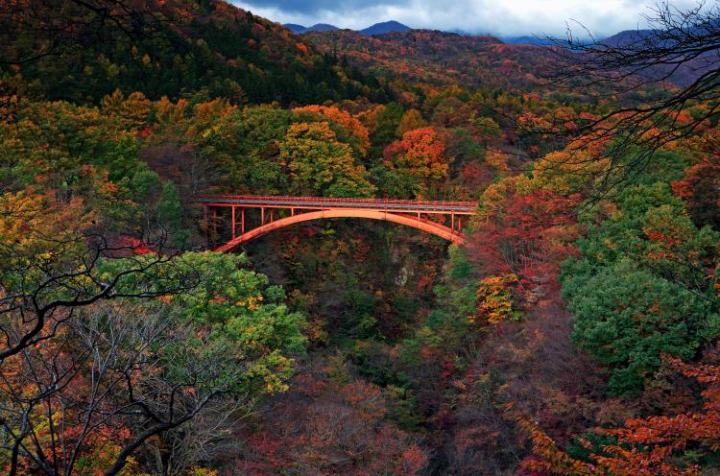
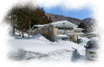
Nature of the NAKADORI area in FUKUSHIMA Ken
|
| |
|
|
|
|
TRAVELMART® is a rare presence in Japanese travel market.
That's because it's only a travel agency in Japan that specializes in arranging
travel throughout the Tohoku region in Japan. |
| The TOHOKU region refers to the northeastern part of the main island, Honshu
of Japan. |
| It's the quintessence of Japan for visit Japan travelers... |
| the most attractive place the most scenic place the most mysterious place |
| |
|
|
| |
| |
|
|
|
|
| |
| |
 Recommended items you won't regret in Nakadori area, Fukushima Ken Recommended items you won't regret in Nakadori area, Fukushima Ken
|
Recommended items for the trip will be added sequentially. Please check
back from time to time.
|
|
| Desination |
Outline |
City/Town/Village |
# / Map |
|
|
|
|
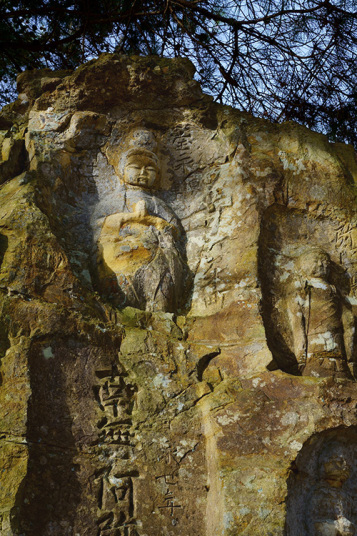
| IWAYA Rock-carved Buddhas |
rock-carved Buddhas statue on the mountainside |
73N001 |
 |
Mt. Shinobu in the city center, there are over 60 rock-carved Buddha statues
carved into the cliffs on the eastern side. They include the Thirty-three
Kannon Bodhisattva, Jizo Bodhisattva, and Fudo Myo-o. Many of the statues
have weathered over the years, but you can still see the serene Buddha
images. Iwaya Kannon is said to have originated as a Kannon hall carved
out of rock by a powerful clan that ruled the area from the Heian to Kamakura
periods, after which an independent Kannon hall was built.
 (external link) (external link) |
FUKUSHIMA(City/Cap) |
 |
|
|
|
|
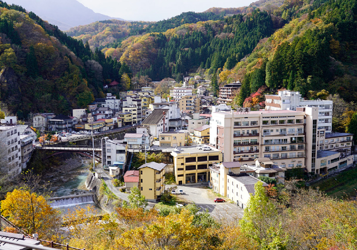
| TSUCHIYU Hot Spring |
a historic hot spring resort |
73N003 |
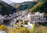 |
It has a history of over 1,400 years as a hot spring resort that also served
as a post station on the Aizu Kaido road (Tsuchiyu Kaido road) that ran
from Fukushima Castle Town to Aizu. It is now located along National Route
115 (Tsuchiyu Kaido road), the shortest route from the prefectural capital
Fukushima City to the Aizu region. Tsuchiyu Onsen has many hot springs,
and you can enjoy hot springs with more than 10 different types of spring
water. The hot spring area is located at an altitude of about 450 meters
and is surrounded by mountains, and the entire hot spring area is designated
as a national park. The local Tsuchiyu Kokeshi dolls are also a representative
local toy of Fukushima City, and it is also known as the production area
of "Japan's Three Great Kokeshi Dolls"
(external link) |
FUKUSHIMA(City/Cap) |
|
|
|
|
|
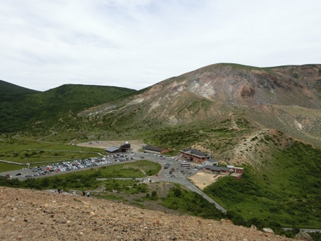
| JODODAIRA Plateau |
a marshland surrounded by mountains |
|
73N006 |
 |
ILocated at an altitude of 1600m, the area is surrounded by volcanic desert and virgin coniferous forests, mainly Abies mariesii. Many alpine plants, coniferous forests, and marshes are also scattered here and there. A visitor center, rest areas, and nature trails have been established, and various levels of activities are available, from an hour's hike starting from here to full-scale trekking. When the mountain tourist road named Bandai-Azuma Skyline opens from April to mid-November, you can easily enjoy the subalpine nature. It is not only a great place for daytime activities, but also a great place for stargazing. In 1993, the Jododaira Astronomical Observatory, the highest public observatory in Japan, was established
(external link) |
FUKUSHIMA(City/Cap) |
|
|
|
|
|
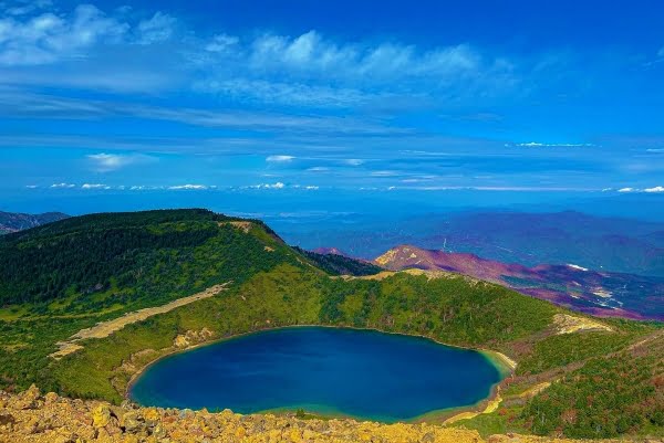
| "the Witch's Eye" |
a cobalt blue lake |
73N007 |
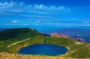 |
This is a crater lake on the mountainside of Mt. Issaikyozan in the Azuma
Mountain Range. Official name is "Goshikinuma" (different from
Goshikinuma in Urabandai, Fukushima Pref.), but it is also called "Witch's
Eye" because it has a beautiful cobalt blue color, and the water fills
a crater about 300m in diameter, and its color changes from moment to moment
depending on the sunlight. You can get to "Witch's Eye" by walking
about 90 minutes from Jododaira on the Bandai Azuma Skyline, which can
be reached by car, and you can view it from the summit of Mt. Issaikyozan
at an altitude of 1,949m. There is no path that leads directly down to
the shore of the lake from the summit. It is a sight you will never forget
once you see it. BTW, don't forget that it is a bear habitat!
(external link) |
FUKUSHIMA(City/Cap) |
|
|
|
|
|
| Mt. RYOZEN |
a low mountain, but a thrilling mountain |
73N009 |
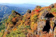 |
Mt. Ryozen, a historic mountain over 1200 years ago, is a low mountain
with an elevation of 825m, but it is dotted with impressive and unusually
shaped rocks, making it a thrilling mountain. There are well-maintained
hiking trails in the mountain, and you can enjoy a great panorama of the
Pacific Ocean and casual trekking. You can also enjoy beautiful nature
throughout the year. The hiking trails are well-maintained and easy for
beginners to walk, but there are many forks and rocky areas, so there are
some places where you need to be careful. The beginner's course is about
7km long and takes about 3 hours to walk. At the foot of the mountain,
there is a facility named "Ryozen Kodomonosato (Ryozen Children's
Village)", which makes use of nature as it is, and you can stay at
a campsite or cottage. There are also hot springs and accommodation facilities
in the surrounding area, where you can take a day trip to the baths.
(external link) |
DATE(City) |
|
|
|
|
|
| KAISEIZAN Park |
sports facilities and park facilities |
73N010 |
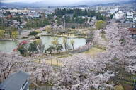 |
This park is surrounded by water and greenery, with Lake Isuzu, which was created as an irrigation pond at the beginning of the Meiji era. It is known as one of the prefecture's leading cherry blossom viewing spots. It is a symbolic park for Koriyama residents. It consists of sports facilities and park facilities. The sports facilities include an athletics stadium, baseball field, archery range, and indoor swimming pool, make them one of the Fukushima Prefecture's sports hubs. The area around Lake Isuzu, with its outdoor music hall and octagonal pavilion (a gazebo) has been developed as a place of relaxation, and is also the location of events such as the Cherry Blossom Festival with night illumination of the cherry blossoms during cherry blossom season and the Summer Festival. Entry is free of charge. However, there may be additional fees when using certain facilities within the park or for events held.
(external link) |
KORIYAMA(City) |
|
|
|
|
|
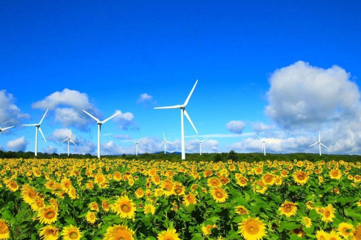
| NUNOBIKI Plateau |
Wind Plateau |
73N011 |
 |
The plateau spreads across Mt. Aizu Nunobiki on the south side of Lake
Inawashiro. At an altitude of about 1,000 meters, it is a plateau with
excellent views, from which you can see Mt. Bandai and Lake Inawashiro.
There are 33 windmills lined up on the plateau, and you can see the spectacular
sight of them slowly rotating in the wind blowing in from Mt. Bandai and
Lake Inawashiro. For this reason, it is called the "Wind Plateau."
In spring, rape blossoms bloom, in summer, sunflowers, and in autumn, cosmos
flowers spread all over the place. The view of Lake Inawashiro, with Mt.
Bandai reflected on the lake surface as seen from Nunobiki Plateau is wonderful.
In winter, the road is closed due to deep snow.
(external link) |
KORIYAMA(City) |
|
|
|
|
|
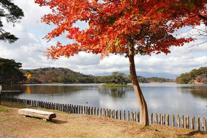
| Lake NANKO Park |
Nanko means "southern lake" in Japanese |
73N021 |
 |
In 1801, the feudal lord created the park as a recreational area for commoners,
regardless of their social status, with the idea of "Shimin Kyoraku"
(the happiness of Samurais and commoners), and it is said to be the oldest
park in Japan. Pine trees are densely distributed on the hills, flowers
are scattered among them, and there is a wide variety of ornamental plants.
There are islands in the pond, making it a sightseeing spot. The name Nanko
is said to come from a line in a poem by the 8th century Chinese poet Li
Bai, or because it was located south of Shirakawa Komine Castle. The park
is about 2 kilometers in circumference, and allowing you to enjoy the scenery
of the four seasons. The teahouse by the lakeside of Nanko Park serves
the famous Nanko Dango (dumplings).
(external link) |
SHIRAKAWA(City) |
 |
|
|
|
|
| SUKAGAWA Poeny Garden |
the best time is from late April to mid-May |
73N026 |
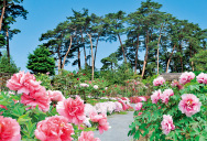 |
The Sukagawa Peony Garden began in the late 18th century when a drug dealer
brought peony seedlings from Settsu Province (present-day Takarazuka City
closed to Kobe) to this area to cultivate them for medicinal purposes.
Today, the vast garden is filled with 290 varieties and 7,000 large peony
flowers. The best time to see the peonies is from late April to mid-May.
Sukagawa Peony Garden is the only peony garden in Japan designated as a
national scenic spot. It is one of the world's largest scenic spots in
terms of size and beauty. An admission fee is required during the peonies'
flowering season, but it is free to visit at other seasons.
(external link) |
SUKAGAWA(City) |
|
|
|
|
|
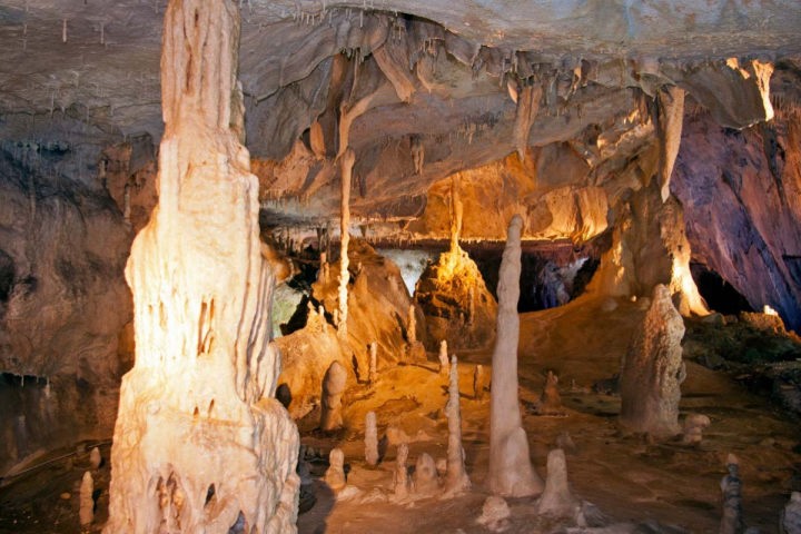
| ABUKUMA Cave |
one of leading limestone caves in Japan |
73N027 |
 |
Abukuma Cave was discovered by chance in 1969 during limestone mining.
It is one of Japan's leading limestone caves, with a total length of 4,218.3
meters and 600 meters public section, and is home to a wide variety of
stalactites. The beauty of nature's creation over time fascinates visitors.
The average temperature inside the cave is around 14°C, and since it does
not fluctuate much throughout the year, wine is also stored there. Part
of Abukuma Cave is a tourist cave, with a 600 meters general course and
a 120 mmeers exploration course. The Fureaikan (contact house) named "Hoshi
no Mura Fureaikan" and the Observatory named "Hoshi no Mura Astronomical
Observatory" are both maintained as a single facility in the area.
(external link) |
TAMURA(City) |
|
|
|
|
|
| YAMAMOTO Shrine |
for good luck and protection from misfortune |
73N033 |
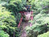 |
Founded in the early 9th century. After passing through rows of cedar trees over 100 years old and climbing up 130 stone steps, a giant rock cave appears at the top of the steps, and within the cave is a sacred site where the principal image of the deity is enshrined. The Miyagawa River, a tributary of the Kuji River, flows through the grounds of Yamamoto Fudoson Shrine, and yamame (scientific name: Oncorhynchus masou) trouts swim in the clear stream. The blessings of this place are good luck and protection from evil. The surrounding valley has been designated a "Prefectural Natural Park," so you can enjoy the rich nature to the fullest. From late October to November, the leaves turn a stunning red in this area.There is also a campsite.
(external link) |
TANAGURA(Town) |
|
|
|
|
|
| YUKIWARIBASHI Bridge |
meaning broken snow bridge in Japanese |
73N034 |
 |
The bridge located upstream of the Abukuma River, the second longest river in the Tohoku region. It spans the deeply carved Yukiwari Gorge, resembling the Grand Canyon. It is about 50 meters above the gorge, and looking down from the bridge will make your legs tremble. It is surrounded by steep rocks. The view of Yukiwari Bridge from the observation deck on the adjacent promenade is spectacular, and many photography enthusiasts visit in the autumn foliage season. At the foot of the bridge there is restaurant, souvenir shop, a park where you can have a barbecue.
(external link) |
NISHIGO(Village) |
|
|
|
|
|
| |
|
|
|
| |
|
|
|
| |
|
|
|
| other contents |
|
|
Medical Tourism
|
|
|
| Japan - the country of advanced medical care! |
 |
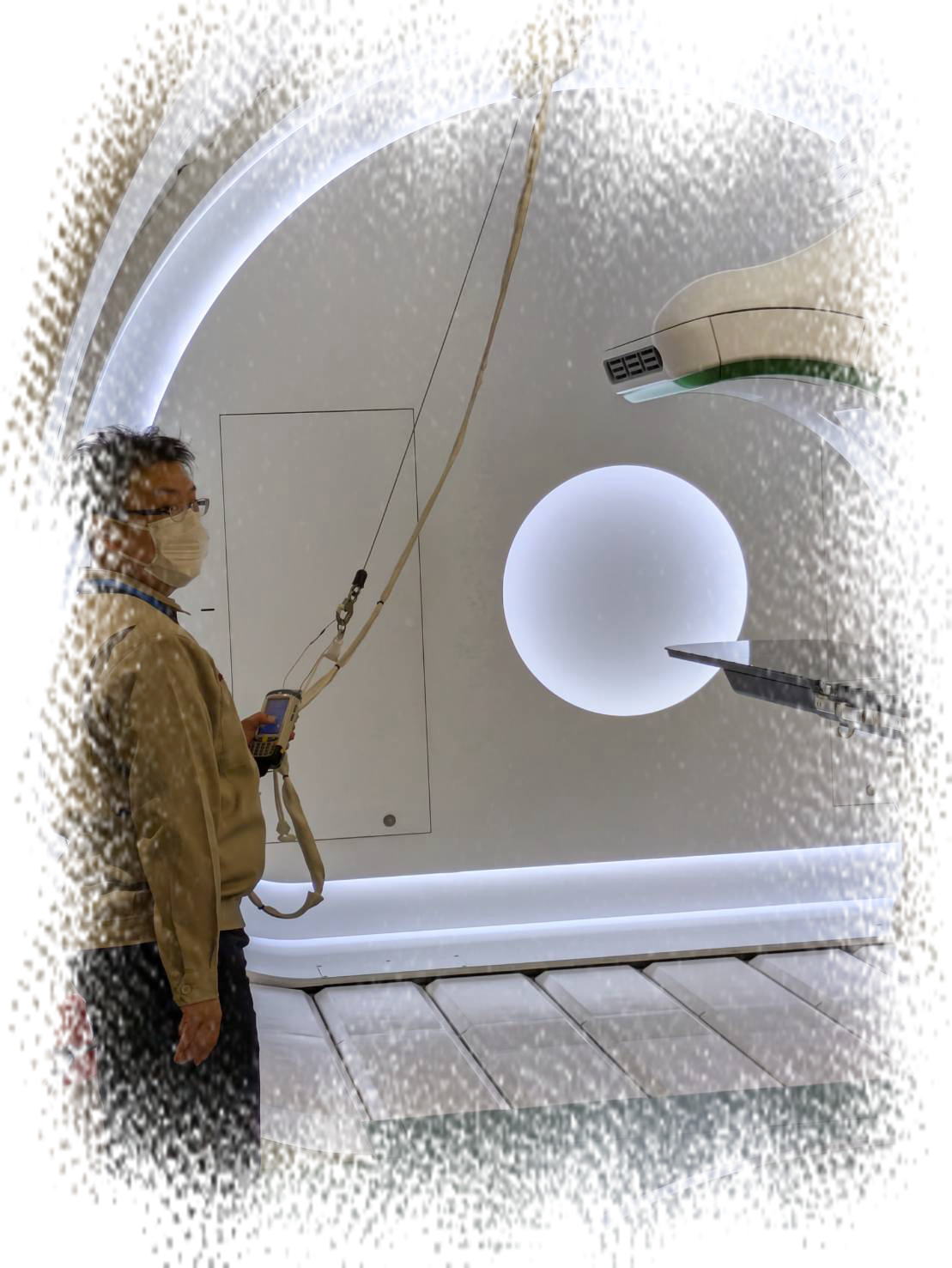
| Cancer can be cured without surgery |
|
|
|
Properties' Research-Purchase Tourism
|
|
|
| Japan - stable politics and public safety! |
|
| Perfect for living or investing |
|
|
| |
|
| |
|
ACCOMMODATION - HOTEL, RYOKAN (Traditional Japanese Inn)
|
|
|
|
|
| |
|
| |
| |
|
|
Trips abroad for Japanese Travelers
|
|
|
| a custom-made trip is the one you won't regret |
|
|
|
|
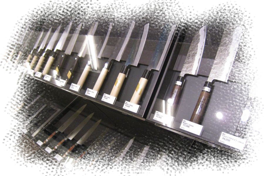
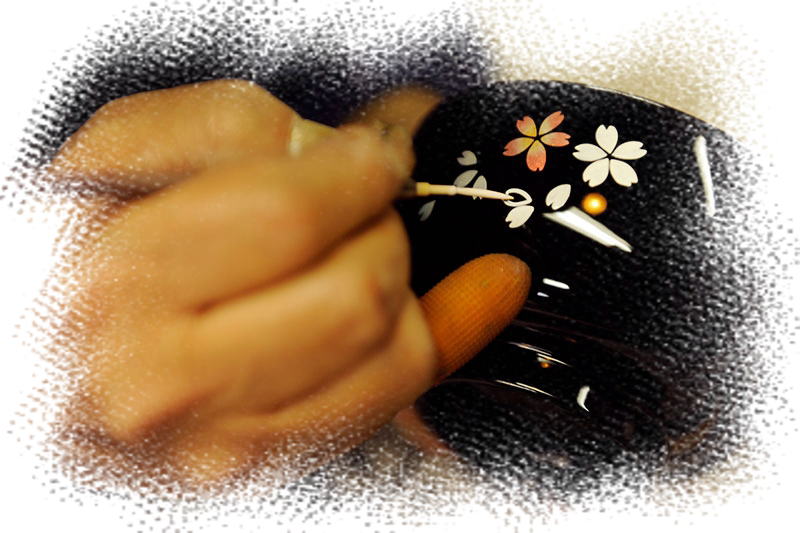
shopping @ TRAVELMART
|
|
|
| You can purchase Japanese masterpieces |
|
|
|
| |
|
|
| Discover something in Japan! |
| TRAVELMART® is not only a travel business, but also can offer clients valuable
experiences in Japan by its wealthy network and know-how, as ... |
| Medical care, Real estate (purchase, investment, management), Purchase
Japaese masterpieces, Relocation to Japan and Establishing a company or
shop, others |
|
| Copyright... IMA Group Co., Ltd. (Wholesaler and Travel Agency in Japan
since 1985) |
| <about link> these web pages are always Link Free. You can feel free to create link to every pages.
|
|
|